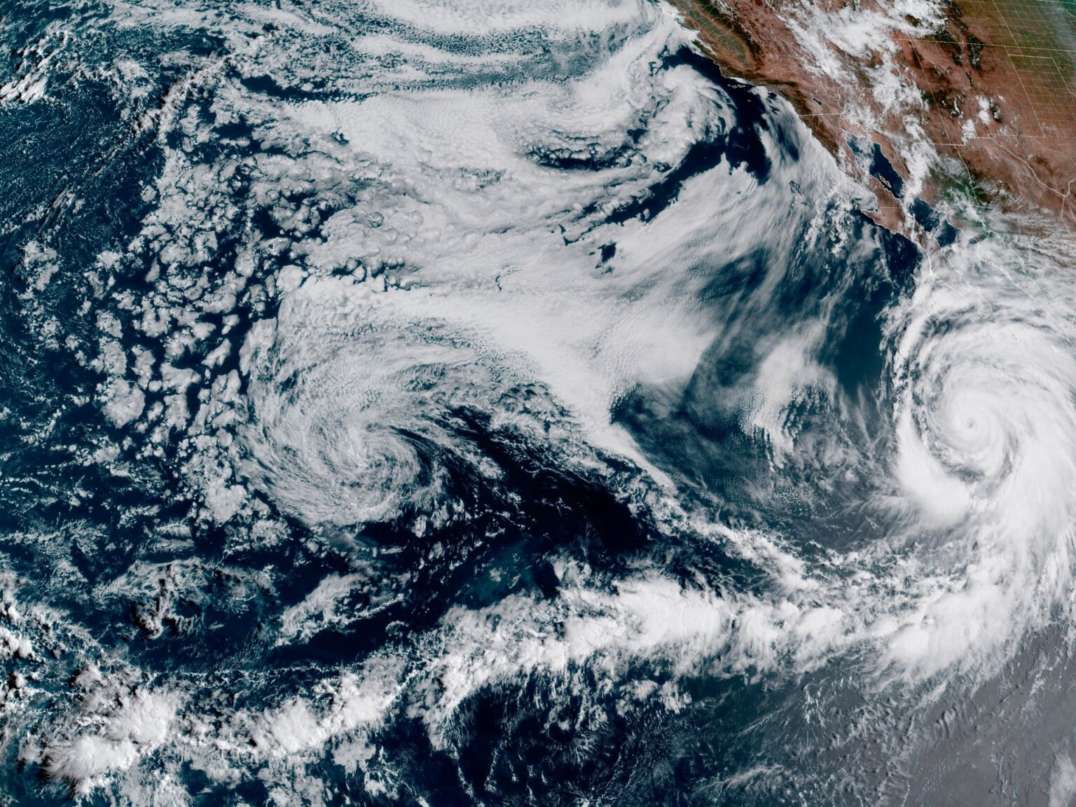
The Category 4 hurricane is anticipated to make landfall in the Mexican state of Baja California before moving north.
The National Hurricane Center in the United States has issued its first-ever tropical storm watch for the southern tip of California as Hurricane Hilary approaches.
The watch, issued on Friday, indicates that tropical storm conditions — including rough seas, heavy rains and winds up to 117 kilometres per hour (73 miles per hour) — are possible within the next two days.
But the designation also makes history in California, a state which, despite its long coastline, has not seen a tropical storm strike in nearly 84 years.
“It is rare — indeed nearly unprecedented in the modern record — to have a tropical system like this move through Southern California,” Weather Channel specialist Greg Postel told CBS News.
Hurricane set to hit Mexico
Currently a powerful Category 4 storm, Hilary has also prompted a hurricane warning along the Baja California peninsula in Mexico, where it is expected to make landfall on Saturday night into Sunday morning.
The cyclone strengthened rapidly on Thursday, reaching the second-highest category on the five-tier Saffir-Simpson scale by Friday. Meteorologists recorded sustained winds of 230km/h (145mph), some gusts going even higher.
In response to the approaching storm, the government of Baja California suspended classes, postponed sporting events and closed ports to small-vessel traffic along the affected area, as coastal waves reached heights of up to 7 metres (23ft).
Marina del Pilar, the state governor of Baja California, also called for residents in vulnerable areas to seek shelter elsewhere.
The hurricane warning extended from Punta Abreojos to Punta Eugenia, an area known for its wildlife refuge and fishing towns which juts into the Pacific Ocean around the midsection of the Baja California peninsula.
But the hurricane is projected to continue northwards to more densely populated areas. The US National Hurricane Center warned of possible flash flooding, along with other hazards.
“A dangerous storm surge is likely to produce coastal flooding along the western Baja California peninsula,” the centre explained. “The surge will be accompanied by large and destructive waves.”
A California rarity
By Sunday, Hurricane Hilary is projected to weaken to tropical-storm strength as it approaches the US-Mexico border. It is not yet clear whether the storm will make landfall.
Nevertheless, California cities like San Diego and Los Angeles are bracing for heavy rains and winds, with isolated areas expected to receive up to 25cm (10 inches).
“Rare and dangerous flooding will be possible,” the National Hurricane Center said on Friday.
California has a relatively sparse history with tropical storm systems. Cold currents travel south along its coast, making conditions unfavourable for tropical storms, and winds tend to push them westward.
“It has been a very long time since an actual intact tropical-storm-level tropical cyclone has made landfall anywhere in California,” climate scientist Daniel Swain said in a presentation on Wednesday, as reported by the San Francisco Chronicle.
The last time a tropical storm made landfall was in September 1939, when a tropical system called El Cordonazo struck near Long Beach, California, as part of a string of storms.
Newspapers put the death toll as high as 93 people as the storm caught many residents unaware. Some drowned in the Pacific. Others died as a result of the flooding, as El Cordonazo brought record rainfall.
More recently, California has experienced the remnants of cyclones, including 2022’s Hurricane Kay, which sent bands of rain into the state after weakening to a tropical storm.
But a direct hit remains a rarity in California, which recently emerged from a years-long drought as a series of atmospheric rivers walloped the state from late December through March.


